
Pushing Through

A couple of mornings ago, it was 5 degrees. The sparrows are flocking up. There is yellow now in the trees that fringe the river. We know what that means. That which we must not mention is coming but let’s agree to not complain yet. We’ll have lots of time to complain when we’re stuck inside. For now, it’s unofficial autumn. As Ian Tyson sings, Think I’ll head out to Alberta, weather’s good there in the fall…This day at least, Ian was right.
But I wasn’t right. I was a tad woozy when I got up and I still wasn’t feeling chipper when I put on my hiking gear. I was fully caffeinated, hydrated, and fueled, and I wanted to explore but without the hard work of hiking up and down those steep hills, battling the ironstone scree that rolls and slides on the unstable bentonite that sits below. Going down is the hardest. You pick your way down, looking for flat-ish spots for foot fall and avoiding the sprays of ironstone chips or loose bentonite. Ideally you land your feet on embedded rock but most often the best available footholds are the humps at the base of white sagebrush, silver sagebrush, and greasewood. The absolute best for ascent and descent are the north-facing hillsides covered in creeping juniper, which forms a cushion, the one and only soft spot you’ll find in the prickly, jagged badlands.
One final point on this. The plateaus are the most deceiving. I have fallen on my ass twice recently, not while climbing or descending but on a hilltop while standing on a slight slope of those treacherous ironstone chips. A dozen other times I have almost gone down while on slight grades where I assumed (there’s the word to watch) that I was stepping on to stable ground. This despite having an indispensable hiking pole, but it’s not enough. You’ll be interested to know that I’m considering growing a tail, like you see with mountain lions, to help me keep my balance. There are ointments on the internet. I’ll let you know how that goes.
I arrived at the valley precipice and started down, deciding I would explore a water course at the bottom of a steep valley a couple of ridges over. I had peered down at it from ridge top a few times before, but it was hard to access. The easiest way was to walk right to the riverbank and follow a ten-foot-high bentonite wall for a couple hundred metres and then look for the inevitable water channels that empty into the Red Deer. I came to one that looked like it should be the right one and started up. First though, water and a banana. I was already light-headed and nauseous, and I needed to make sure I didn’t get dehydrated on top of it.
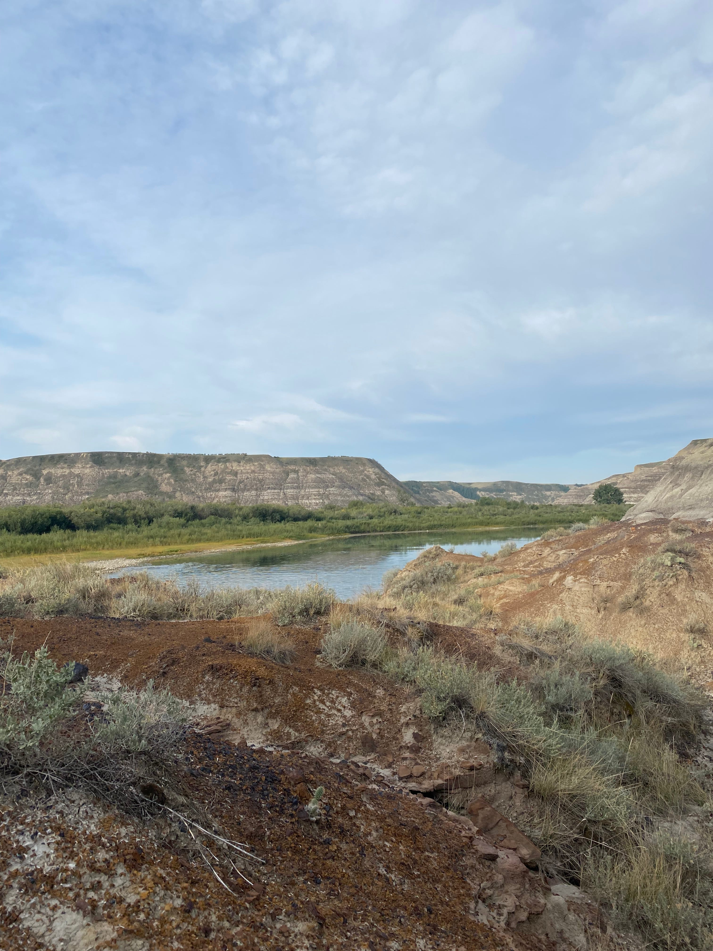
The channel was shallow and wider where it purged itself into the Red Deer. On either side, small low hills and, right away, lots of dinosaur bone. I did a cursory look about. The bone was plentiful but as the paleontologists say, it was “disarticulated” and “disassociated”, which means, not joined together in a skeleton and spread all over. It also didn’t seem especially significant, so I pushed on, but I will return. The area warrants closer inspection.
It didn’t take long before the high hills pinched in and the going got tough. What I couldn’t tell from the ridge top, 80 feet above, is that big chunks of the hills on either side had slid down into the channel over the last many years make the walking tougher than usual meaning I was probably one of the few people who would bother to walk it. Good! Unfortunately, my head also felt a little disarticulated and disassociated from my body, an extra challenge for me that fine Sunday morning. That was less good.
The great side benefit of exploring for fossils in the badlands is that every ten feet you get to see something new. For instance, the channels themselves are just so interesting. They sculpt, reveal and carve, such as they did here.
(If you get my emails from Substack you can see the pictures in the article when I make reference to them. Facebook places them all at the bottom of the article. Sorry. You’ll have to talk to Zuckerberg about that)
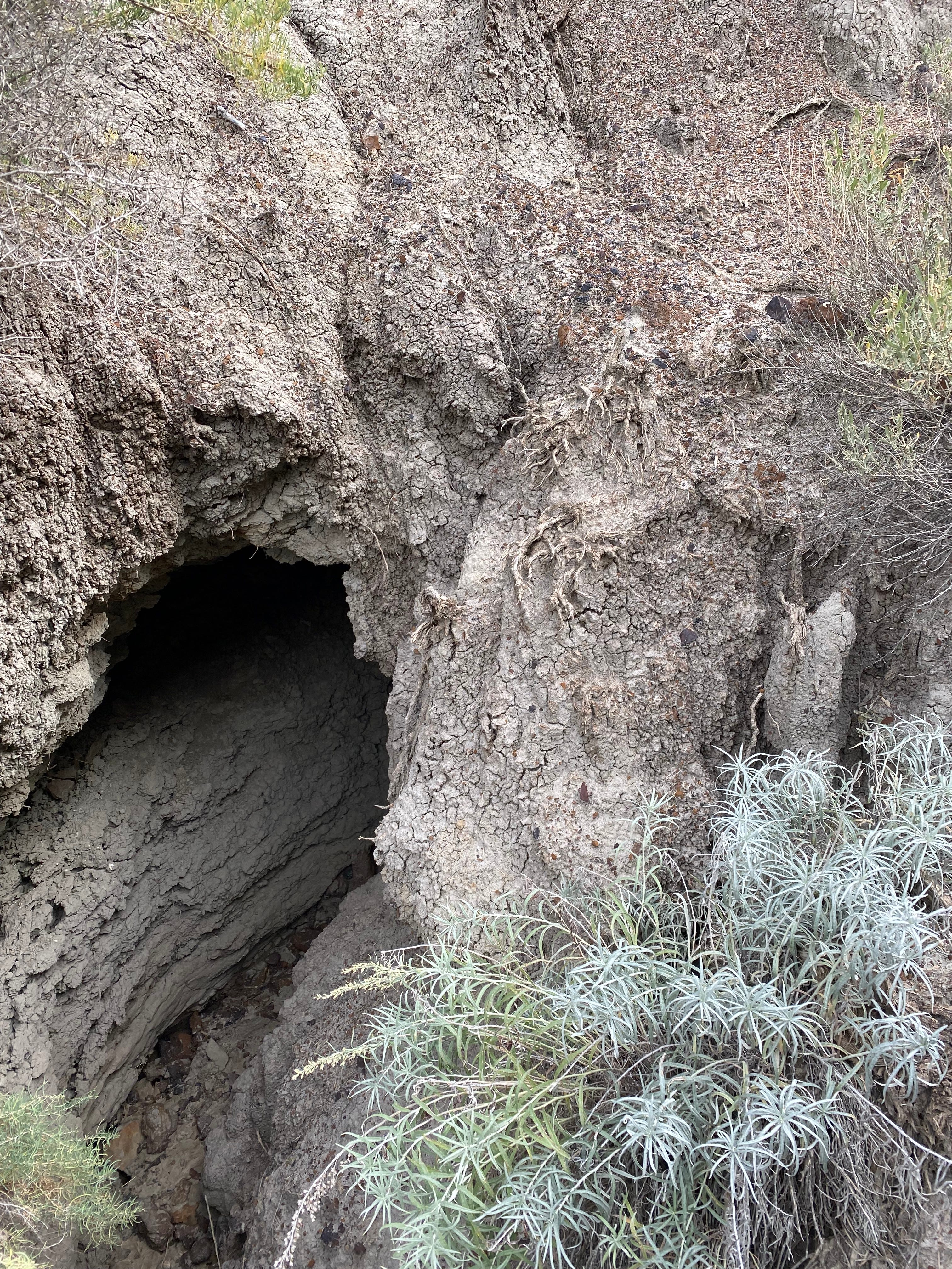
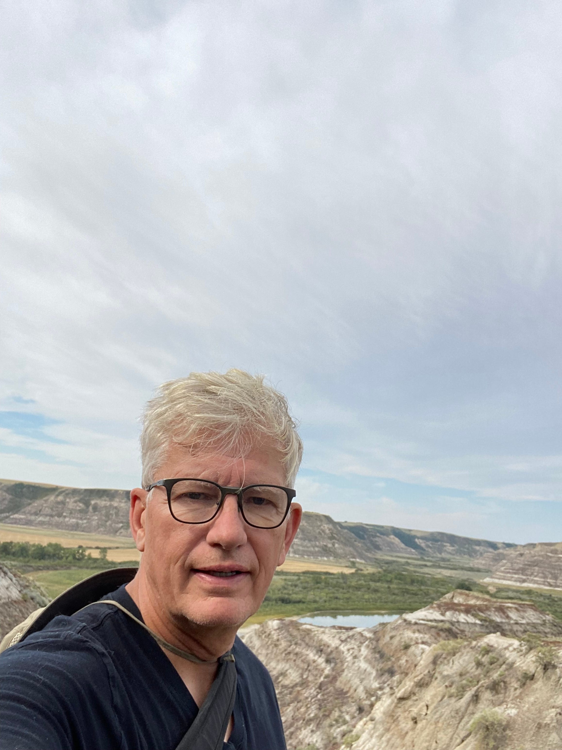
The tunnel in the picture is probably 8 or 9 feet long and the channel is about 10 feet deep. I didn’t stick my head in. Next time perhaps. I pushed on and found gleaming bone here and there and a few sites that deserved more exploring but nothing worthy of the front page of National Geographic or even the Drumheller Mail. By this point I had been out for maybe three hours and decided it might be wise to cut my little adventure short. I still had an 80-foot ridge to climb and then descend and then up another 170 feet or so to the truck (this is the channel from the top) So, I began.

At one point I carved foot holds in crumbling bentonite to struggle out of a bowl-shaped area that fell down a dozen feet to a water channel. I felt like an ant on the Nature Channel trying to escape an ant lion pit, while the hungry ant lion waits at the bottom, concealed just below the surface, with massive pincher jaws and a bad attitude. When I got to the ridge top, I saw the gleam of bone on a rounded hilltop, perhaps 15 feet high. But there was no easy way up. Once again, I carved foot holds and crawled to the top. There was no great paleontological reward, but I did get a view as I walked a narrow ridge with a long drop to the right. I decided I would try to fall to the left if I fell. I didn’t fall but I considered it.
I was feeling pretty punk by now, so I slowly made my way down the hummock, down to the ridge top plateau and down the least bad course to the valley bottom. Then it was across the valley floor and back up the next ridge all the way to the truck.
As I write this, I’m feeling much better (Thanks for thinking about asking!) I might even hit the badlands again today. If I do, I’ll let you know all about it.